Ten archaeological sites for understanding ancient Mexico
A pyramid is one building in a city. The plazas, the houses, the roads, the reservoirs, the carvings, the burials and the shape of the ground around them are what tell you how people lived and who was in charge. This list is arranged by the question each place is best at answering, rather than by how tall anything is.
How to look at a site without reducing it to one monument
A site name covers a city occupied for different lengths of time by different peoples. One building can have several construction phases stacked inside it, and the route open to visitors today may show only a fraction of the settlement. The INAH signs and the site museum are better company than a tour script that has one story and sticks to it.
Nine of the ten below are UNESCO World Heritage properties. Tulum is here to cover the late Maya Caribbean. It is not a scorecard.
Ten places, ten questions
1. Teotihuacan — how was a huge city organized?
The Avenue of the Dead links the monumental complexes, but the apartment compounds and the mural painting are where the daily life is. Urban scale, centuries before the Mexica.
2. Monte Albán — how does terrain express power?
Zapotec builders levelled a mountain summit above the Oaxaca valleys. The plazas, the carved stones, the tombs and the sightlines make the landscape itself part of the political statement.
3. Palenque — what can inscriptions recover?
Architecture, sculpture and Maya writing connect rulers, dates, ritual and dynastic history. The forest around it is part of the protected property, not scenery.
4. Chichén Itzá — what happens when regions meet?
Maya building traditions and elements associated with central Mexico appear in the same city. The Great Ball Court, the Temple of the Warriors and the observatory each argue a different part of that.
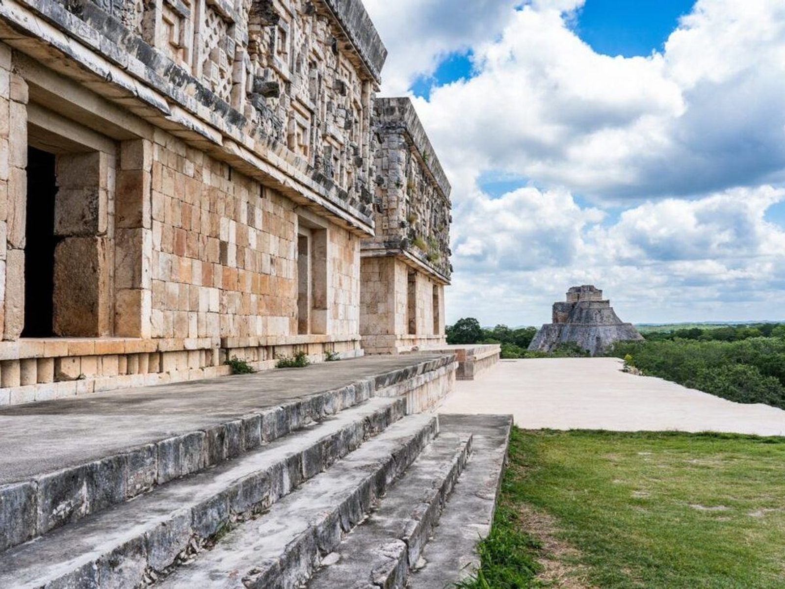
5. Uxmal — what defines Puuc architecture?
Long façades, stone mosaic, masks and carefully composed courtyards: a regional architectural language adapted to low hills and to a place with no surface water.
6. El Tajín — how did relief and terrain shape a city?
Carved panels, ball courts, terraces and the Pyramid of the Niches on the Gulf coast, from a period UNESCO places at its height after Teotihuacan.
7. Paquimé — why does northern Mexico change the map?
Adobe compounds, water systems and evidence of long-distance exchange, in a desert. It breaks the habit of telling this history as stone cities in the center and the south.
8. Xochicalco — what followed Teotihuacan?
A fortified hilltop with terraces, plazas and carved imagery, belonging to the political reorganisation after Teotihuacan declined.
9. Calakmul — how did a city use forest and water?
Reservoirs, monuments and a very large Maya urban center inside protected tropical forest, where the archaeology and the ecology are managed together.
10. Tulum — what did late coastal trade look like?
A walled city using a Caribbean position, a small cove, East Coast architecture and mural painting, during the Postclassic.
What to look for beyond height
Water
Reservoirs, wells, drainage and cenotes explain how a settlement carried people through the dry season. In the Yucatán this is the whole question.
Movement
Roads, causeways, stairs, gateways and plazas control who could reach a space and how a crowd assembled in it.
Writing and images
Stelae, reliefs, murals and inscriptions can name rulers and events. What they mean belongs to current research, not to guesswork, and the guesswork is usually more dramatic.
Homes and work
Residential platforms, workshops, storage and food remains tell you more about a city than its temples do.
Later change
Abandonment is rarely a single moment. Buildings get remodelled, reused, buried, looted, excavated and conserved, across centuries.
You are walking through the evidence
Do not cross barriers, climb closed structures, touch reliefs, move stones or leave the marked paths. Those rules protect you, and they protect material that is still being studied — a great deal of these sites has never been excavated. Drone and professional-camera rules vary by site and are enforced.
Check INAH for hours, last entry, accessible services and current fees. At Tulum the process now involves charges from more than one authority, which makes a screenshot from last year an unreliable budget.
Choosing a Maya site from the Caribbean
From Cancun, Chichén Itzá is the major inland route. From Tulum, the coastal city is the obvious local one. Uxmal and Calakmul need entirely different road plans and should not be described as nearby alternatives, because they are not.
The Chichen Itza guide covers that route. Confirm the day’s access with INAH, and remember that heat, last entry and the journey home matter more than squeezing another stop into the same ticket.
Traveler questions
Which of these is oldest?
Why are some pyramids closed to climbing?
Is Tulum a UNESCO World Heritage site?
Are the artefacts still inside the buildings?
Does one ticket cover everything at Tulum?
Sources
- UNESCO World Heritage Center, Mexico propertieswhc.unesco.org · checked 2026-09-25
- UNESCO World Heritage Center, Chichen Itzawhc.unesco.org · checked 2026-09-25
- UNESCO World Heritage Center, El Tajinwhc.unesco.org · checked 2026-09-25
- National Institute of Anthropology and Historylugares.inah.gob.mx · checked 2026-09-25
- National Institute of Anthropology and History, Tulumlugares.inah.gob.mx · checked 2026-09-25